| High Adventure |
|
Codorus State Park Mountain Bike Trails |
|
|||
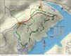
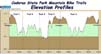
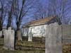
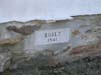
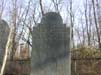
In January 2002, Joe Kaehler and Bob Zinn mapped the Codorus State Park Mountain Bike trails using a GPS. The Maps were created using Delorme's Topo 3.0 mapping software. The GPS used was DeLorme's Earthmate. Printable versions of the map and profile are provided in Adobe PDF format. Joe provided the photographs of the historic Wildasin Meeting House.
|