|
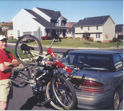
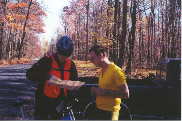
A few members of the High Adventure Club attacked the mountains and trails in the Frederick Watershed area. Riders: Animal (Ed Ramsey), Gadget (Bob Zinn) , and Cyko (John J.) Below: Animal loads up the bikes for the big ride.
Ride and Trail Descriptions: Animal and
Gadget took their Mountain Bikes and tackled new trails in the
Catoctin Mountains within an area known as the
Frederick
Watershed. The
watershed is located between Gambrill and Cunningham Falls State
Parks. The parking area
is located on Hamburg Road between Gambrill Park Road and Fishing
Creek Road. There are
two trailheads across the Hamburg road (North) from the parking area
that takes you into the Frederick Watershed area. Another trail south of the
parking area takes you to Gambrill State Park. Cyko, a pharmacist from
Brunswick, Maryland, joined Animal and Gadget. Cyko drove up as we were
just about ready to begin the ride. Cyko was familiar with the
trails in the area and agreed to lead the ride on the North West
(left) trail. The weather was partly cloudy with the temperature
around 50 degrees.
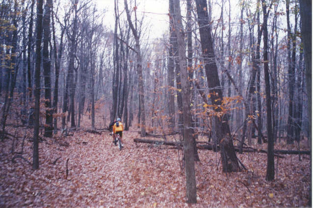
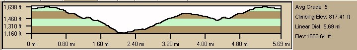
The terrain was mostly flat and easy for the first half mile of the
ride.
During this
section of the ride, Bob's front wheel became loose and almost fell
off after jumping a few trees.
Quick adjustments were made and the group continued on a mile
long 270-foot elevation decent to a small lake. We had to dismount the bikes to
get around a small tree.
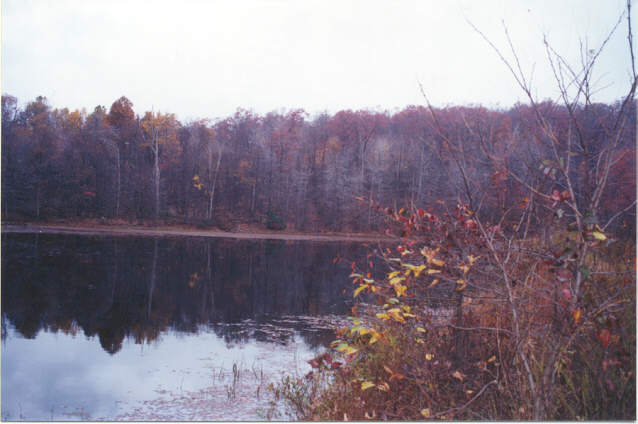
We approached a small lake and took a
break. Gadget needed to make additional adjustments to his bike. The
rough riding began to take its toll on his bike.
Animal took pictures of the repair efforts made at the
lake. Before we took
off again, Cyko began to tell us stories about when he had jumped
off a big rock near this lake.
Animal and Gadget urged him on to repeat the jump off this
6-foot ledge. He was not wearing his
protective knee and elbow gear, and Cyko came to his senses and aborted the reenactment.
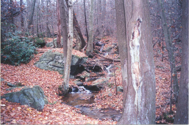
From the big rock by the lake, we continued a quarter mile down the very steep, rough and
narrow trail that paralleled a stream on the left.
About three quarters of the
way, we stopped near a 12-foot drop-off to the stream. Cyko told us how he jumped
the stream from the 12-foot ledge a few weeks ago. In the process he broke the
bike's crank. Cyko
likes to ride trails every week and said he even went on a night
ride. Back to the
trail... We continued
down the steep narrow trail to the Fishing Creek Road. We turned left onto the road
and followed it for about 0.8 miles to a short distance to
Delaughter Road. We
turned left on Delaughter and immediately crossed a stream. Yes, we rode right through
the water. With our
shoes and socks soaked, we began to climb. About 3/4 up the mountain
we turned left onto a logging trail. We passed a house on the
left and turned left onto another trail that would take us back to
the lake and parking area.
Below: Cyko and Gadget are already planning their next trip. |


 Send mail to
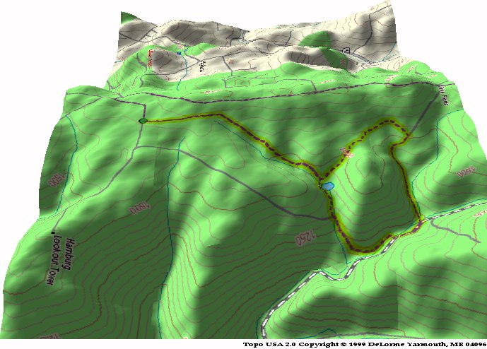