Ride Route 1 Topo Map
Ride Route 2 Topo Map
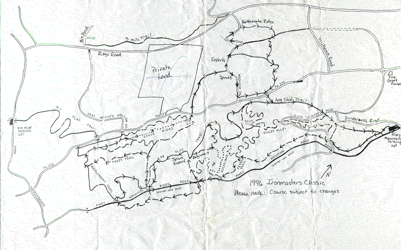
Furnace Area 3D Map
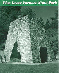
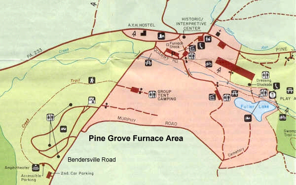
Park Map
Here is Mountain Bike Riding information for Michaux or the Pine Grove Furnace Area. Ride Route 1 - Snowmobile, Single Track and Log Sled Trails Ride Route 2 - Laurel Lake, Cold Spring Road and Leaf Trail
Ride Route 1 - Snowmobile, Single Track and Log Sled Trails See the Ride Route 1 Map for references for this ride. From the Furnace Parking lot, take the Bendersville Road south for about a 1/2 mile to the Snowmobile trail head. This trail head is off to the left and just past a clay mining area on the left. There is a a steep dirt mound blocking the trail head entrance. (If you cant find the trail head, then just stay on Bendersville road to the top.) Take the Snowmobile Trail to the top where it meets Piney Ridge Road (dirt) and Bendersville Road (paved). At this intersection, there is a large mountain top parking area across Bendersville Road. Go though this mountain top parking area and find the trail at the far end (West end). This trail is shown on the map as as a blue hatch trail and it is a single track. Follow this single track trail for a about a 100 yards and cross the ATV trail. Continue on the blue hatched single track for about a mile. Here you will cross the Slate Quarry Road (double track). Continue on the single track which has moderate to easy climbs but is technical. If you follow the single track to its end (another 2 miles) you will end up on Piney Ridge Road (dirt) that comes into view on your left. You can follow the Piney Ridge Road to the west for about 0.4 miles where you can pick up a connecting trail on the right. This steep down hill connecting trail resembles a dry bed creek and connects to the Log Sled Trail (dirt logging trail). Take a right onto the Log Sled Trail and continue on the trail until you reach the bottom (Near the gate marked on the map). Feel free to take any of the blue blazed side trails off the Log Sled Trail. The Log Sled Trail will begin to climb back up the mountain toward the mountain top parking lot. This climb is on a good surface and is not technical. Half way up you will cross Slate Quarry Road. If you turn left, it will take you to Bendersville Road. I suggest you go to the parking lot at the top and return to the Furnace on the Snowmobile Trail. The Snowmobile Trail is a blast coming down. Ride Route 2 - Laurel Lake, Cold Spring Rd, and Leaf Trail. See the Ride Route 2 Map for references for this ride. Park at the Laurel Lake Parking Lot located on Pine Grove Road and Laurel Lake. Begin by crossing Pine Grove Road and proceeding up Cold Spring Road (Improved Dirt) for about 1 1/2 miles. The Leaf Trail Head is to the left when the Cold Spring Road takes a sharp 90 degree right. Follow the Leaf Trail until you cross the Iron Run stream. Continue for another 1/2 mile where it intersects with another trail to the left. This is just before Route 233. From this point you have two options: Option 1 - Daugherty Trail Turn right onto Lepper Farm Road and go down the hill. Cross the Pine Grove Road and follow the YMCA Camp road to the lake. Turn right at Pine Grove Road and head back to the Laurel Lake parking area. Option 2 - Fuller Lake and Railroad Bed Road
Turn left onto Quarry Road and continue gate just to the right of the Restrooms. Proceed on the AT trail past this gate and follow until you cross over the steam at Fuller Lake. To the far left of the lake, you cross over the steam and onto the Railroad Bed path. This is still the AT trail. Continue on this path until you get to the Pole Steeple parking area on the back side of Laurel Lake. If you get a chance, hike the Pole Steeple path for a fantastic view of Laurel Lake. Expert riders may be able to ride most of the way, but it is really steep. Pole Steeple is at the top of 100 foot quartz cliffs. After taking in the view, take the trail back down to the parking area. Expert riders may want to continue on the back side of Pole Steeple and take a left onto the Old Forge Trail. From the Pole Steeple Parking area, proceed to the right around the lake to the Laurel Lake Parking area. |
 Send mail to
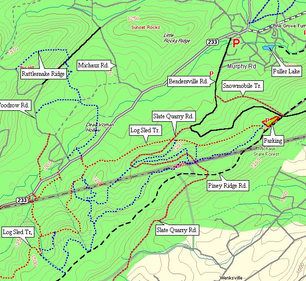