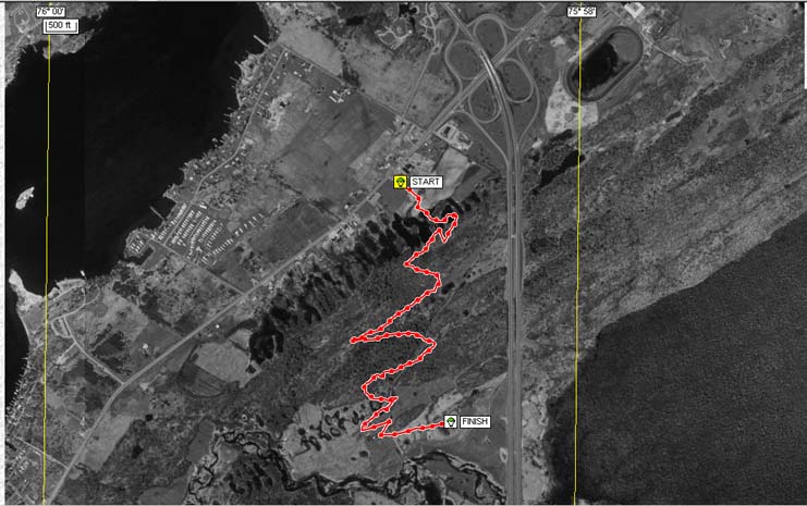
Aerial Image showing path of flight. We traveled just 2.8 miles as we zig-zagged our way. The total linear distance was 0.8 miles. Different winds at various altitudes allowed Ken to have some control of our path.